Visualizzazione post con etichetta Hiking. Mostra tutti i post

martedì 15 aprile 2014

Hiking La Dorsale del Triangolo Lariano

Ever since I heard about La Dorsale del Triangolo Lariano, a trail that goes from Brunate, the village at the top of the funicular above Como town, to Bellaggio, the town at the point of the triangolo that divides Lake Como into two branches at its southern end, I had wanted to hike it. And when, a couple of weeks ago, I finally did tick it off my bucket list, I wanted to add it straight back on to the bottom again.

We arrived in Milan by train, then took the Trenord service to Como from Milano Cadorna. We stocked up on picnic provisions at the little grocer on the corner between the train and the bus stations, which turned out to be a great move, as the food was excellent. After that, a quick ride on the funicular took us 500 vertical metres from the lake shore up into the mountains to the start of the trail.
Monte Boletto
You can download a detailed description of the trail here, so I'll just pick out some of the highlights. We arrived at the top of Monte Boletto, where you the first big panorama of the lake and the Dorsale ridge leading on ahead of you, just in time for lunch and a spot of lazy sunbathing. Often along the trail you have the choice between the Dorsale and the Dorsale per Cresta, which takes you over the top of the summits. Generally speaking, the time difference isn't huge and the views from the Cresta (ridge) are better, but, this being the first big hike of the season, we found walking with our 2-day backpacks quite tiring and alternated between the Cresta and the standard path.

We spent the night at the Albergo del Dosso in Pian del Tivano, which turned out to be a fantastic choice. The owners were very kind and welcoming, the rooms were comfortable, and the food (and the artisanal beer, I'm told) was fantastic. Dinner started with a buffet of salads and vegetables, then we had a choice of several pasta dishes or the local polenta speciality for the primo. Many of us chose the polenta, which was served with herbs, cheese, garlic and olive oil and was so filling that I coudn't even finish mine. Those who could manage also had a meat secondo (again there were a few options) while the rest of us opted for a delicious selection of local cheeses. For dessert, there was fresh fruit or a choice between two home-made fruit tarts. I would highly recommend Il Dosso, but just be aware that it's at the opposite end of Pian del Tivano from the Dorsale trail. We did as the pdf guide said and hiked along the road, but from the map it looked as if you could also take a different turning at Monte Croce and come out more or less at the hotel.

View from Monte San Primo
Day two started with an easy walk up a river valley, eventually leading to the ridge of Monte San Primo, where you are suddenly confronted with the most beautiful panorama of the whole trail, looking up the lake to the Swiss mountains and along down the ridge to Bellaggio. There was still a bit of snow when we were there, but it was an easy  descent, even if some sliding did go on, down into the forest.

Sentiero del Viandante
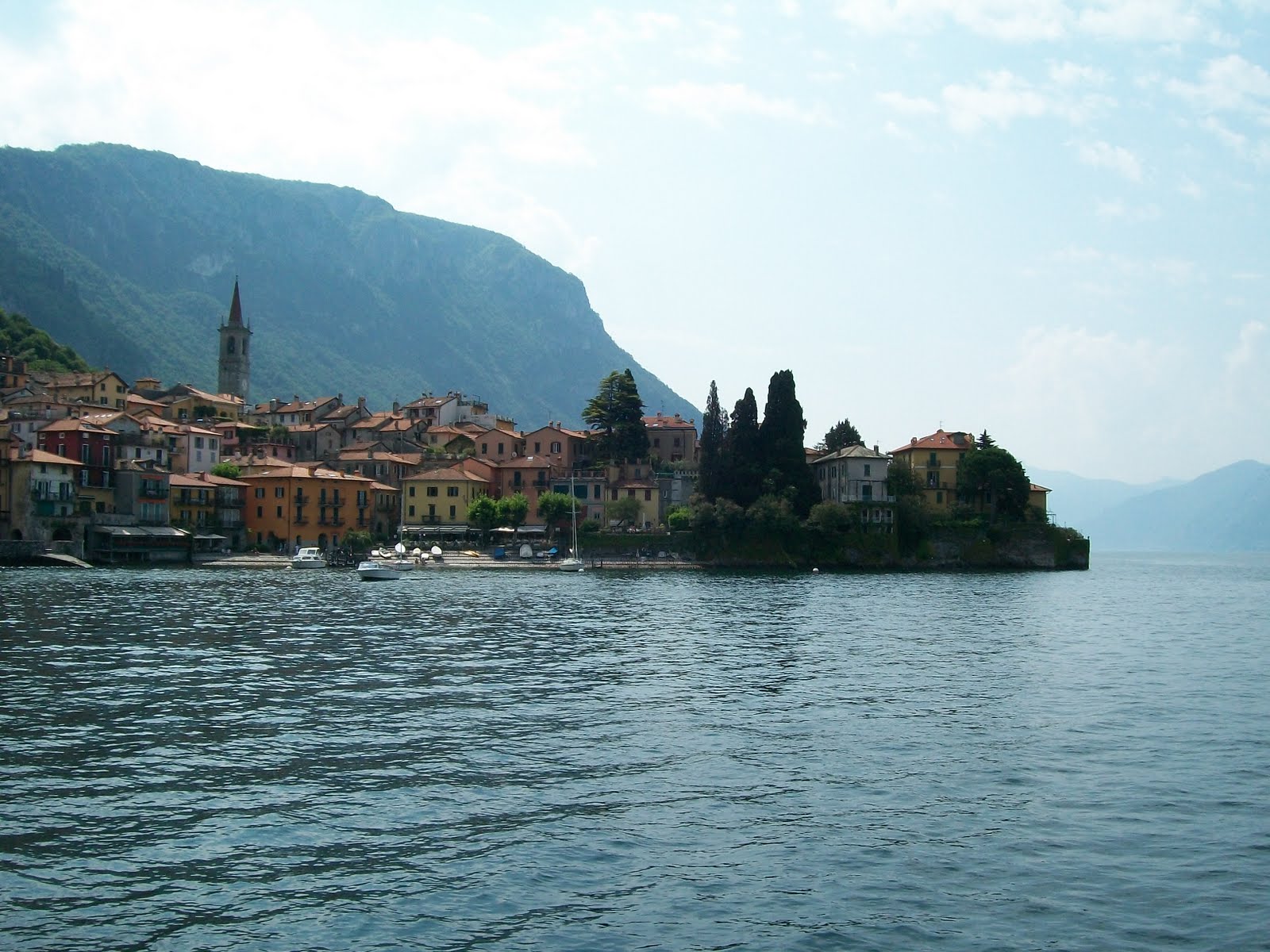
We went on from Bellaggio to Varenna, where we stayed for another day and strolled along the Sentiero del Viandante, which is also beautiful, but you can also take the ferry back from Bellagio to Como and complete the trip in 2 days.

venerdì 17 agosto 2012

The Lagazuoi Tunnels

The last via ferrata of my Italian trip was the easiest, but the beginning was almost as dramatic as the day before. Having decided not to take the cable car from Falzarego, we were coming to the end of what should have been an easy hike up to the top of the mountain where the via ferrata started when the voices of the gods roared, the heavens opened, and we were caught in a mighty thunderstorm. We were only about 20 minutes away from the refuge, but with the path turned into a small stream and rivulets of water streaking down the mountain, 20 minutes was plenty of time to get soaked.


It was perfect timing for the owners of the refuge, however, as we weren't the only ones that took advantage of it being lunch time to order a hot meal and dry out before making our way out across the ridge to where the via ferrata started.

It's hard to tell amongst the jagged stone of the Dolomites, but an enormous chunk of the mountain above Falzarego is missing, not because of natural erosion or disaster, but because during World War One, the Austrians were dominating the ridge from the top and the Italians were lurking lower down. Neither side was making much progress until the Italians, who had created a network of tun.nels in the mountain below, used explosives to blow away a giant section of the crest. The tunnels have now been turned into an outdoor museum and you can rent an audioguide and read information pannels as you make your way along the iron cable to the bottom.

The via ferrata was only a level 1 and we didn't use harnesses, but we were glad of our helmets, torches and fingerless gloves for holding on to the cables. Spending an hour inside a mountain in dank tunnels isn't exactly pleasant but it does give you some inkling of what life was like for the poor soldiers who carried not only all their provisions but tonnes of explosives and weaponry up the steep paths, then slept in the stone caves in inadequate clothes for the subzero winter temperatures. What is harder to understand, of course, is how these men were able to put up with such circumstances for so long, especially with the hindsight of knowing what a terrible waste the whole war turned out to be.

giovedì 26 luglio 2012

Via Ferrata Merlone

Monday was my second real day of via ferrata-ing and I made dramatic progress, from a scariness point of view if not a technical one. We decided to take on the Ferrata Merlone, a short, but very exposed climb in the Gruppo dei Cadini di Misurina.

We parked the car just beyond the Lago di Misurina and hiked up a trail through the forest, across a beautiful Alpine meadow filled with what seemed to be an amazing variety of flowers, given the dry desolation of the barren rocks that towered above it. From the Rifugio Fratelli Fonda-Savio it was a short walk up the Alta Via trail to the start of the via ferrata.

Iron Ladders
There is not much that requires particular skill about the Ferrata Merlone, but that can be hard to remember when you are several hundred vertical metres up a rock face, with nothing but stones, scree and thin air beneath you. Parts of the route are scrambly, but most of the climbing is actually done on iron ladders attached at a variety of angles to the mountain. I was able to avoid thinking too much about the exposure and the only part I found at all scary was what the guidebook described as an "airy traverse" - a few horizontal metres on a particularly vertical part of the cliff, with only a slippy and somewhat broken ladder for assistance.

Tre Cime di Lavaredo
We ate our sandwiches at the top and enjoyed the views across to the Tre Cime di Lavaredo, but the clouds were drawing in and we soon decided it was time to head down. Unfortunately, a group of about 20 Czechs had decided to come up at that exact moment and they made their turnaround just as we arrived at the top of the cables. With the sky growing ever-darker, we started to make our painfully slow descent in the middle of their group, but after a couple of pitches the raindrops started to fall and, with all those people in front of us, we were going nowhere fast. To top it off, they were clipping 3 people at a time into each section of the cable (you should never have more than one person in each section, otherwise if one person falls they can knock the other off) and a few of them, with clumsy feet, were frequently kicking stones down the mountain, despite the fact that other members of the group below weren't even wearing helmets.

Nobody wants to be caught on the top of a mountain in a thunderstorm, but while being attached to an iron cable is about the worst thing you can do, sitting a couple of metres away from it is actually fairly safe, as the cable will act as a lightning conductor and draw the electricity away from you. We decided that the threat from the humans was worse than the natural dangers and stepped off to the side of the cable to sit and wait.

Luckily for us, although it rained a bit, the thunder and lightning never came and after about 20 minutes we were able to make our way down to the bottom safely. We had learned our lesson though: if you see large groups of people on a via ferrata, steer well clear!

martedì 24 luglio 2012

Ferrata di Dibona

On Day 2 of my via ferrata experience, I decided to lower my sights a little and attempt a level 2 ferrata, the nevertheless dramatic-sounding Ferrata di Dibona. We took the Dolomitibus from Cortina to Rio Gere, then the ski-lifts carried us up the mountain to Rifugio G. Lorenzo. The first chairlift was hi-tech and high-speed, with a storm cover and padded seats, but the second was more like the mountain equivalent of a Regionale train, so the total trip took a little while (a lot less than it would have taken us to walk, though!). Up at the refuge, it was quite cold and the wind was blowing clouds around the mountain, but luckily not in the direction we were going.
Rifugio G. Lorenzo. On the left you can just see the longest
ferrata bridge in the Dolomites.
The via ferrata starts with some steep climbing, followed by the longest bridge in the Dolomites, which, compared to the scary wire bridge on my first via ferrata, (in St-Christophe-en-Oisans in France) was reassuringly disappointing, being very solid and firmly attached to both sides of the ravine it was crossing. We did the optional climb to the Cresta Bianca, which gave us a great view down to the refuge and the way we had come.


View of the ridge from the Cresta Bianca

The Ferrata di Dibona is essentially a fabulous, exposed ridge walk. It takes the whole day but most of the trail was not difficult at all, and definitely more like hiking than rock-climbing, although there were bits that would have been a bit scary if we hadn't been clipped in to the cable. You can either come down part-way along and take a not-very-pleasant path across some scree and back to the chairlift, or you can carry on all the way to the end of the ridge and down to Ospitale, where there are buses back to Cortina. We chose the second option, which included no less than 1600m of descent but took a very pretty zigzagging path off the mountain. Most other people seemed to be taking the other route down, so we had the path more or less to ourselves and returned to the bottom with aching knees and heads full of the stunning airy views from the ridge.

lunedì 23 luglio 2012

Ferrata dei Alpini

Cinque Torri from Falzarego

A little-known part of the history of WW1 is the battles that were fought in the mountains of northern Italy. The Italians were defending their border with the Austro-Hungarian empire and the ridges and summits of the Dolomites became the equivalent of the trenches in northern France. It seems unbelievable that anyone could fight a war in an environment so treacherous that one insecure footing can kill a modern hiker, but they did, and more soldiers died in avalanches here than were killed by poison gas in the Somme. This was not really a front that advanced, but more a line of defence, and the only territory that was won in the long-term was when Sud Tirol was handed over to Italy and became what is now called Alto Adige. Cortina is in the largely Italian speaking part of the region but in the towns and villages to the north, people speak German and have a stronger regional than national identity.

Remains of a WW1 Hospital at Falzarego

One of the consequences of the war that remains to this day is the network of vie ferrate , or "iron ways" that crisscross the Dolomites. These were originally built to allow the soldiers to traverse the mountains and are essentially assisted rock-climbing routes made up of metal cables that you clip on to, and sometimes steps and ladders attached to the rocks. The easier parts are just exposed hiking trails but the harder ones require real rock-climbing skills.

You can hire the climbing kit at the outdoor shops in Cortina for around 12 euros per day. As I had done one fairly scary via ferrata once before, as well as a (very small) amount of rock climbing, we decided on the first day to tackle a grade 3 route (out of 5), the Ferrata dei Alpini at Falzarego.

I was somewhat daunted by the vertical-ness of the cliff that confronted me at the beginning, but, knowing that rock-climbing is often easier than it looks, I clipped in and got started. Unfortunately, about 3 stages in, there was a point where I needed to step across ... or up ... or even just round a big lump of jutting out rock. And I tried, in every possible direction, with every possible body part, but I didn't yet have the balance in my legs or the strength in my arms and I just couldn't do it.

A little disappointed, I climbed back down and resigned myself to taking the walking path to the top of the route, admiring the view and taking pictures of all the pretty flowers along the way. And when my brother and his wife arrived at the top and confirmed that the rest of the climb was just as difficult (and much harder than the other grade 3s they had tried), I didn't regret my decision at all. Tomorrow, after all, would be another day.

domenica 24 luglio 2011

Alta Via dei Monti Lariani


On Monday, I learned my lesson from Sunday and took the C13 bus 750m up the mountains to the village of Breglia to start my second hike. I was planning to go up to the Rifugio Menaggio, our over-ambitious goal from the day before, and continue on to Monte Grona and beyond, but when I got to the fork in the path leading to the refuge, I decided that "beyond" would be more exciting and set off along the ridge, following the Alta Via dei Monti Lariani.

The one flaw in my plan was that I had meant to fill up my water bottle at the refuge and, by bypassing the highest tap on the mountain, I left myself with limited supplies, which, given that the temperature down in the valley was about 30 degrees, was not very clever. I knew there were some water fountains on the way down, so I decided that I would carry on for as long as my water lasted and turn back as soon as I had drunk the last mouthful. Luckily, this turned out to be the summit of Monte Bregagno, which was about as far as I wanted to go anyway, especially as I had a bus to catch.


As well as having stunning views, the ridge was actually pleasantly cool and I enjoyed myself hugely, stopping for lunch and to admire the views of Monte Grona and Lake Lugano at Sant'Amate before carrying on the the highest point at Monte Bregagno.

It was only as I strode back down the mountain in search of water and the bus, with the temperature seeming to increase by several degrees with every step I took, that I realised how hot the weather actually was. I finished the day with a well-earned gelato from the shop on the main piazza in Menaggio (great ice-cream but very grumpy service!) and a dive into the lake to cook down.

giovedì 14 luglio 2011

Barna and the Valle della Senagra

Varenna from the Ferry

After a Saturday evening of catching up with friends in Milan over some good old spritz Aperol aperitivo and mispronounced cocktails, my friend and I dragged ourselves out of bed early on Sunday morning to head up to Lake Como for some hiking. I was staying at the hostel La Primula in Menaggio, so we caught the train to Varenna (using a free weekend ticket that they've been handing out at the stations recently!), then the boat across the lake. and I was able to drop my suitcase off before we set out on our hike. The Menaggio tourist office publishes a booklet of walks in the area, but many of them require you to take a bus to the starting point and buses on a Sunday are few and far between, so using a hiking map which I had (luckily!) bought in Milan a while back, we combined a couple of their itineraries to make a route of our own, starting at the town centre and aiming for the Rifugio, which was a somewhat optimistic 1400m above the town.

We didn't make it all the way up, mostly because my friend had to get back to Milan that night to go to work on Monday, and in the end it turned out to be a good thing because an enormous thunderstorm began roaring soon after we had turned back and the storm clouds chased us right back down the valley. We did have a good day out though, and saw some interesting sights:


Scary Rock Face in the Valle della Sanagra

I wasn't planning to!

Dinky little Fiat

Barna

Monte Grona

Barometer. The text reads, "If the cord is dry, it's nice weather; if the cord is wet, it's raining; if the cord is stiff, it's cold; if you can't see the cord, it's foggy; if the cord is moving, it's windy and if there is no cord, it's been stolen!

Storm Clouds over Lake Como

sabato 27 marzo 2010

Monte Boletto


It's almost one month since I was in Italy, and high time I finished posting about my trip, but I think subconsciously, I've been putting off writing this particular post.

On the Monday morning, as my friends set off for work, I took the train up to Como to do a walk that I had been wanting to do for a long time. You take the funiular to Brunate and follow the signs to the “faro”, the lighthouse that stands a little higher up on the hillside. From the lighthouse, you follow the red and white signs, which lead you further up the hill, through villages and forest and up on to the mountain ridge. You can follow the "Dorsale" path right the way to Bellaggio, but I stopped at the top of Monte Boletto.


I think I've been scared of posting about this hike because words can't do it justice. Even the photos don't do it justice. When I arrived at th top of the mountain, less than two hours' walk from Como, and saw the dark lake at my feet and the snowy mountains stretching out into the distance above it, their summits reaching ever higher, I felt that I might be in the most beautiful place in the world, and the joy that I felt was bittersweet, because when I left Italy last summer, I left all that world and all its adventures so far behind.

giovedì 11 marzo 2010

Canzo in the Snow


Much as I enjoyed my first day in Milan, one day was enough. I had found all the maps I needed to head to the mountains and I was feeling inspired, so I caught the train to Canzo, the friendliest place in Italy, and set off for a hike.

Despite the smog and the rain in Milan, I was still optimistically hoping for stunning views of snow-capped mountains. Unfortunately, it was raining in Canzo too and as I walked up through the village, I stopped to add waterproof layers as often as I tried to take pictures of the rapidly disappearing mountains.

I started off on the path that Mum and I took last summer, following the signs for the 3 Alpi. After the first alp, however, I left that path and headed steeply up hill on the walker's path to the Corni di Canzo. (There are two paths, but one of them involves a via ferrata, and it wasn't the day for experimenting with that.) As well as being over optimistic about the weather, I was hoping to do the 5 hour walk in 4 hours in order to catch the train back to Milan in time for aperitivo with my former colleagues, so I pushed myself hard to get up the mountain in the snow in record time. As a result, I was slightly breathless and this, combined with being surrounded by bare black trees, fog and a thick blanket of snow, contributed to a very other-worldly impression. I did want to arrive “somewhere” before going back down the mountain, however, so I struggled onwards and upwards, stopping every so often to try to figure out how far I had gone and whether I was going to make it or not, which was tricky given the snow underfoot and the total lack of visibility.


I didn't make it right to the Corni themselves, but I reached the rifugio, which made a satisfactory end point to the climb, and let myself rest for an inadequate two and a half minutes before turning round and heading back down the path.


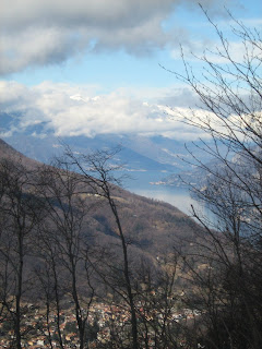
The whole effort became worth it, though, because just at that moment, the mist and clouds began to lift and suddenly gorgeous views of the Lago di Lecco and the Triangolo Lariano began to appear through the trees. In the distance, I could even see the snow-capped mountains.


I caught the train back with minutes to spare after jogging gently down a large section of the track. and arrived at the bar in plenty of time. I peered through the window, but couldn't see anybody I knew inside. Three of my friends were already there, however, and my loud friend Rachel must have said something loudly because just as I was turning to cross the road and check at the other bar, the Chinese bar girl came running out, calling my nickname after me in her very Chinese Italian. And once again, I felt back at home in Milan!

lunedì 31 agosto 2009

Stresa in the Sunshine

I realised that after my long story about sly old ladies skipping the queue at the train station, I never posted anything about my actual day in Stresa.

I've probably said this before, but I love Stresa. It's as if they combined the best of Italy and Switzerland and put them into one little town surrounded by stunning mountains and lakeside scenery.

That day two weeks ago, my first goal was to do something energetic, so I got the cable car up to Mottorone (Ok, so not that energetic!) and set off for a bit of a hike. This is where I finished up:


If I hadn't been starving and short of water, I would probably have done the 2.5 hour walk back down to Stresa, but under the circumstances I decided that it would be better to go back to the cable car. In the interest of diversity, I decided to go back a different way, and it turned out to be steep, exposed and definitely longer than the way I came. The sun beat down and the sweat dripped off me and the half hour back to the cable car seemed endless. I arrived looking as though I had been swimming and was too embarrassed to sit in the restaurant to eat, so after mopping myself down in the toilets, I bought a sandwich and found a place to hide among the trees to eat it.

Then I got the cable car back down to Stresa and jumped straight in the lake, which is probably what I should have done at the very beginning. Hiking at midday in 35 degree heat is not good for your health!

martedì 14 luglio 2009

Hiking in the Triangolo Lariano


Mum arrived for her visit on Tuesday night. On Wednesday, I sent her off to Bergamo while I did boring but useful things like going to the bank and shifting boxes with Mr. A. On Thursday, however, I decided it was time to join her on holiday and we went for a hike in the Triangolo Lariano, which is the bit of land between Lake Como and Lake Lecco.

You get the train there from Cadorna station in Milan and get off at Canzo station. Just outside the village, there are lots of marked walking trails up into the mountains beyond. A friend had recommended the area to me, but unfortunately I only vaguely remembered the directions she had given me and it took us about an hour to find the tourist office and get out of the village. It's just on the left as you walk up the hill from the train station into the centre of town, but we managed to miss it and did a couple of circuits of the village, asking three passers-by where it might be. The last person we asked was an old man sitting on a bench outside the bar who had probably seen us go past twice and very kindly took pity on us and actually led us to the door of the comune, where the office was housed. That door turned out not to be the actual door for the tourist office, but the woman was incredibly kind and went and got all kinds of maps for me, including one that she gave me for free but I'm sure I should have paid for. She must have realised that somebody who was looking for tourist information in the anagrafe office, which deals with things like residency and taxes, was clearly in need of a map.

Once we had the maps, it took us another couple of circuits of the town to find the right way out. There are 5 or 6 routes, all signposted with the traditional red and white striped markers, and we weren't quite smart enough to remember the number of the path that we wanted to take, which led to us taking another detour, this time up a very steep hill, but eventually we got ourselves on the right one and were heading for the Tre Alpi.

The walk up to the Primo Alpe was steep but not too difficult. The path was shaded by trees and we saw lots of pretty orange butterflies. At the top, there's an education centre and a picnic area. The Secondo and Terzo Alpi turned out to be very close to the first one and the path flattened out, so that part of the walk was easy. On the way, there is a chapel of St Miro, who apparently brought rain to the area during a long drought, and at the top there's an agritourismo. It was a bit late for lunch by the time we got there, but we had a drink, admired the farm tools and the corns hanging from the walls and the ceiling and watched the owners chasing the goats out of the house.

We wanted to go down by a different route, but it wasn't signposted and after our experiences in the morning, we decided it was safer to follow the main path, especially as the thunder was starting to rumble. We made it back to the village just as the raindrops were becoming really big, and were just in time for a train back to Milan.